Help us map Washington’s maritime heritage
Spanning 3,000 miles of Washington State’s saltwater shoreline, the Maritime Washington National Heritage Area recognizes our state’s unique and diverse maritime culture. This new designation supports our coastal communities in celebrating, maintaining, and sharing their water-based stories. This year, we’re working with local residents and organizations to chart a course for the heritage area. In addition to hearing from you through virtual public workshops and surveys, we want your help identifying the sites you value along our shores.
That’s why we’ve created a new virtual map where you can mark maritime places that are meaningful and important to you. On the map, you can identify resources and sites related to our saltwater shorelines, adding photos, historical details, personal stories, and more for each location.
How to use the site
Adding a Resource
First, think of a place you’d like to add to the map. We know that “maritime heritage” means different things to different people, so we encourage you to think big! We’re looking for any and all sites related to how you experience maritime heritage and culture. This includes anything—historical or present-day—connected to how humans interact with the sea. Some examples include:
- A historic lighthouse or ship
- Your favorite beach or shoreside picnic area
- A public tribal museum
- Your local seafood market
- A naval shipyard
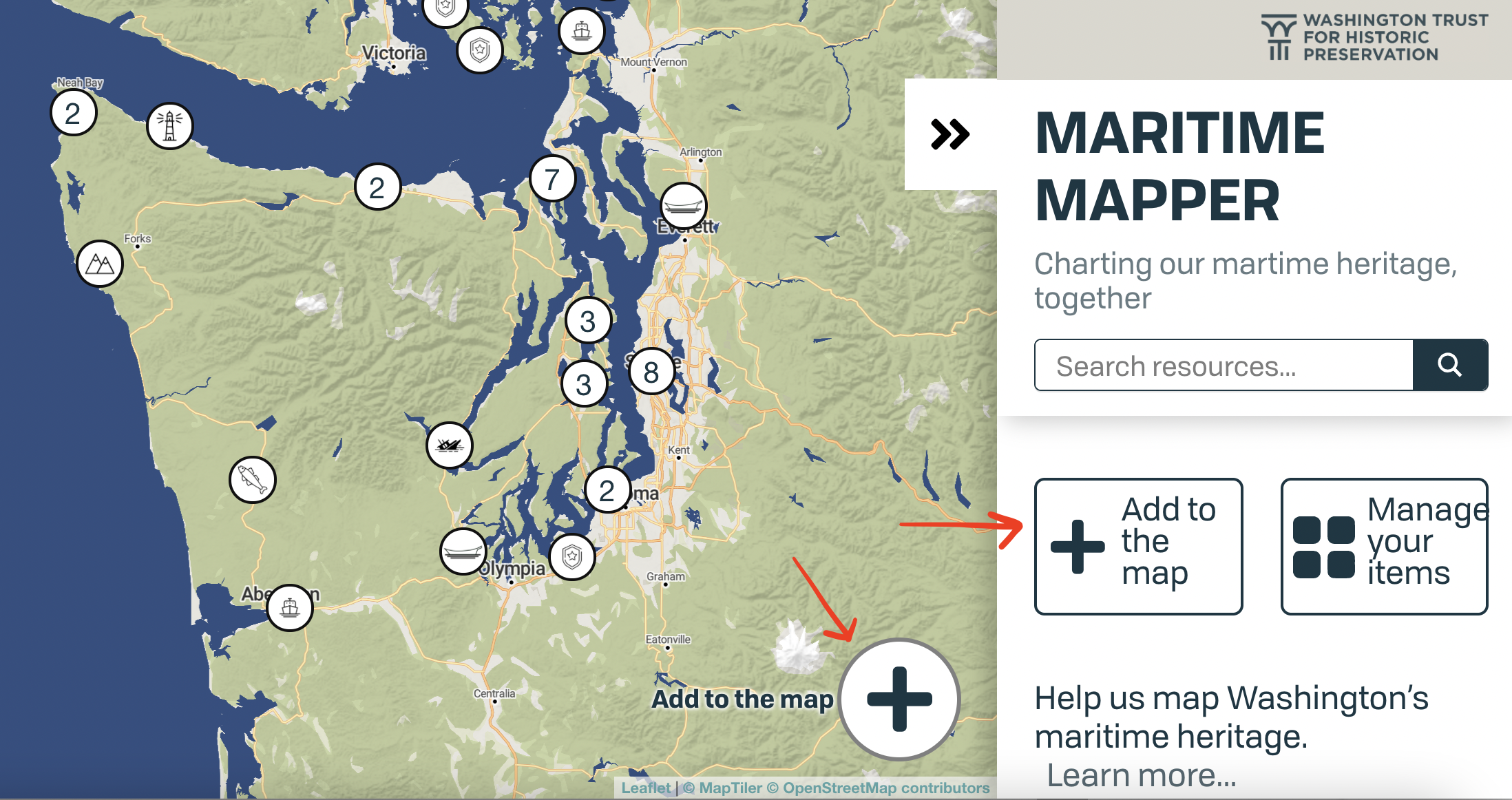
Then, get started by clicking one of the “Add to the map” buttons on the home screen.
TIP: Make sure the site you want to add isn’t already on the map by typing the name into the “search resources” bar.
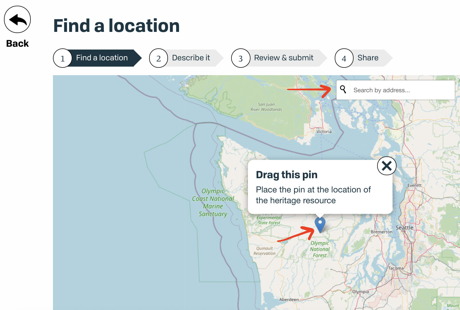
Next, find the location of your maritime site by either dragging the pin to the right spot on the map or typing the address into the search bar at the top of the page. Adjust the pin’s location as needed, and then click the “Next” button that appears on the bottom right corner of the map.
On the “Describe it” page, fill in the requested fields to tell us about your maritime resource. Use a well-known, easily identifiable name for the Title to assist other users.
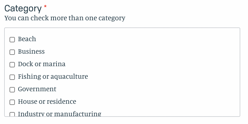
The “category” field helps tag your resource and link it to other, similar sites. Be sure to scroll down to see all the options and remember that you can select more than one. By identifying the category or categories your place fits into, you will help us weave together and interconnect the wide range of sites along Washington’s shorelines. These categories will also assist other users in exploring new maritime resources and sites.
If you’d like to add information that doesn’t fit in these fields, click “Add more detail.” Here, you’ll find additional fields including address, current use, a space to put links and YouTube videos, personal stories, topic or theme, and miscellaneous information.
TIP: The information you add here will be made public to other users, except for your name and address. You can also choose to keep your personal story private.
Once you’re finished adding the information on your site, click “Next.” You’ll have a chance to review your new pin before submitting it. If you want to add multiple resources and keep track of what you’ve submitted, you can also choose to create an account and manage all your contributions in one place; however, you do not need to create an account in order to add resources or use the site. After you submit your resource, you’ll be able to share it right away.* It will also be added as a pin to the map, so others can explore and build on your submission with additional pictures, details, and stories.
Exploring the map
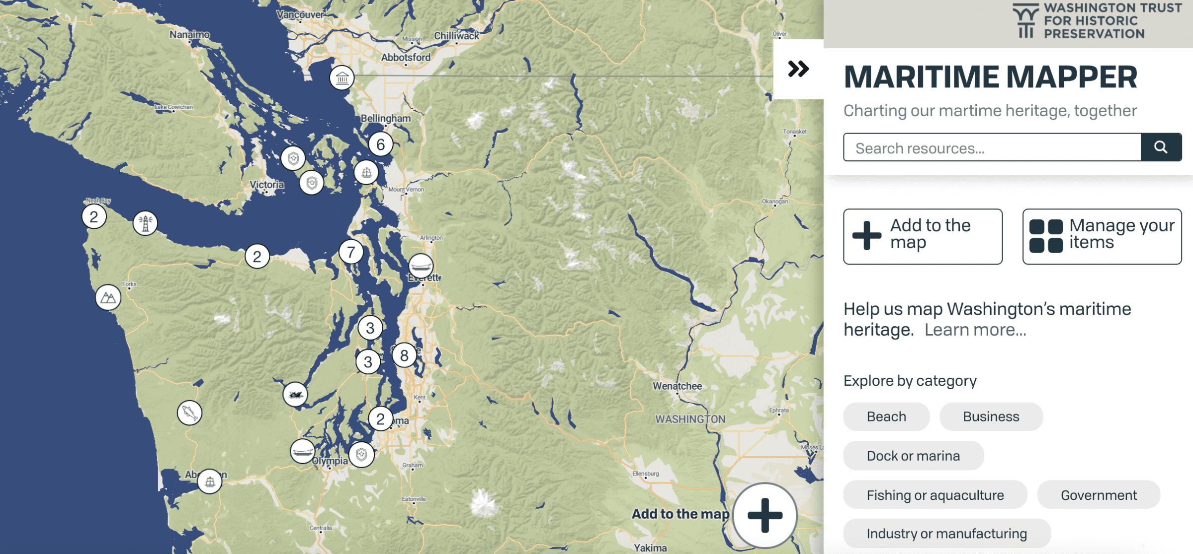
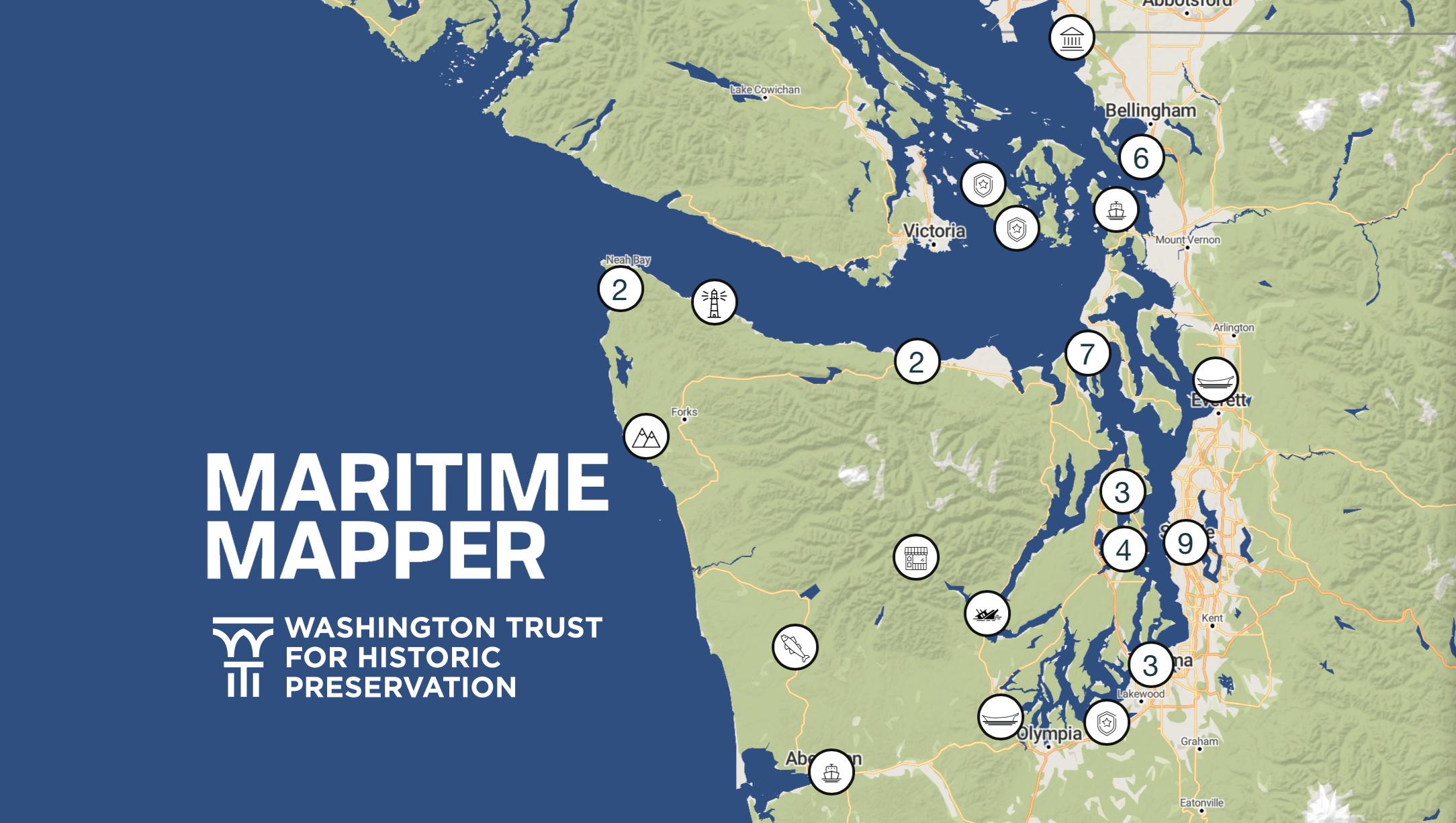
To explore sites added by others, simply click on one of the circles on the map. The icons indicate the site type, while the numbers indicate that there is more than one resource in that location. Click on the number to zoom in and view the resources in that location.
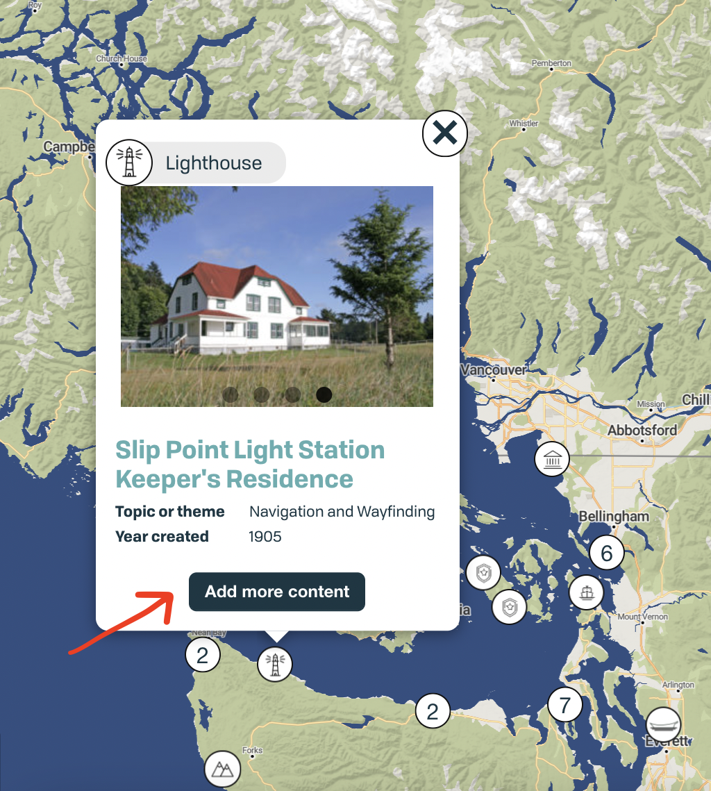
A pop-up will give you basic information about the location, as submitted by other users. You can click on the name of the resource (in light blue) to learn more. You can also click “add more content” to suggest edits or submit your own personal stories about each site.
The sites you identify will be used to help create a plan for the Maritime Washington National Heritage Area. By hearing from you about which maritime resources are important to our coastal communities, we’ll be better able to craft a heritage area that supports, protects, and shares the stories of these places. Down the road, the resources identified through this interactive map may also be used to create materials, tools, and programs to help local residents and visitors alike plan trips, explore maritime resources, and discover new adventures to be had along Washington’s shores.
We can’t wait to discover your favorite hidden pearls along our saltwater shores!
Please note: Out of respect for our tribal partners, any sites marked as “tribal facility” will require a short review period before going live.